
Following Abraham’s Trail: From Ur of the Chaldeans to the Promised Land
Based on Expedition Bible video • Travel + archaeology + biblical context
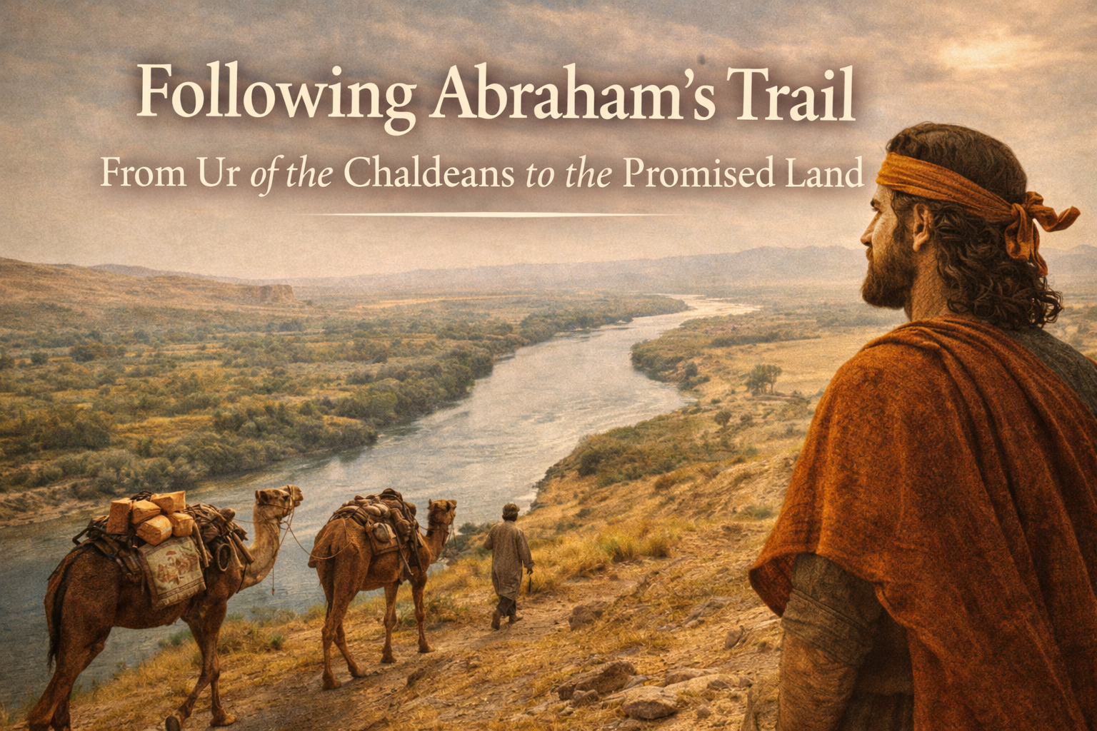
What would it actually feel like to leave everything behind and walk (or travel) into the unknown, simply because God called you? In this video, Joel Kramer and his team try to do something wild: start at Ur of the Chaldeans (Abraham’s hometown) and follow the most realistic ancient route to Canaan, crossing modern borders, rivers, and regions that still shape the journey today.
Big takeaways (quick overview)
- Ur is identified through archaeology and inscriptions that preserve the city’s ancient name.
- The route makes sense geographically: in the ancient world, you followed water (especially the Euphrates).
- Haran matters, and inscriptions tied to the moon-god cult help confirm the site’s identity and context.
- Modern borders complicate everything, but they also highlight how long and costly Abraham’s journey really was.
- The point isn’t only geography. It’s faith: Abraham did not know the destination, but he knew who he was following.
1) Starting in Ur of the Chaldeans
The journey begins at Ur, identified as “Ur of the Chaldeans” in the biblical text. In the video, the case is made that this site matches the biblical Ur because early excavations uncovered cylinder inscriptions that preserve the city’s name, and because Chaldea is associated with southern Mesopotamia near the Persian Gulf region.
Key idea: It’s not just “a cool ancient ruin.” The team is trying to stand where Abraham stood before he ever stepped into the unknown.
2) Why the Euphrates basically chooses the route for you
Genesis gives only a short line about the move toward Canaan, but the video highlights something practical: ancient travel depended on water. Herds, people, supplies, and survival all point to following major rivers. That is why the team follows the Euphrates River north instead of attempting a direct desert route.
This “river logic” is one of the most helpful parts of the video because it turns a simple Bible verse into a realistic journey map. You can actually picture how a family would move over weeks and months, not in a straight line, but along a lifeline.
3) Through Babylon and into the real-world difficulties
The team passes places Abraham would have passed, including the region of Babylon, while continuing to trace the Euphrates north. Then the video turns from “historical travel” into “modern reality” fast: checkpoints, suspicion toward foreigners, tense areas, and even a moment where a falling bullet strikes their windshield (they explain they were not being targeted).
A small but memorable detail
They also stop at traditional water wheels that lift water into aqueducts for agriculture. It’s a visual reminder that water management is not a modern obsession. It’s ancient survival.
4) Waiting for Syria, then following the Balikh toward Haran
A big turning point is the uncertainty around entering Syria. The team has to wait for special permission, and when they finally cross, the route continues along the Euphrates until the place where a key tributary meets it. From there, they shift toward Haran (Harran), because Haran sits in the Balikh River region.
The video makes a simple point: Abraham’s path is not random. It follows geography, water, and known travel corridors. The route becomes more believable the more “unromantic” it gets.
5) Haran: archaeology, inscriptions, and the “why here?” question
In Haran, the team visits an area connected with excavation history and points to inscriptions that mention the city, including links to Nabonidus and the worship of the moon god (Sin/Nanna) in this region. The video’s suggestion is that this helps confirm the setting and also explains a possible reason Abraham’s family paused here.
Genesis says they reached Haran and settled there for a time. The video leans into the human side: Abraham is older, childless, living in the tension between a promise and the reality in front of him.
6) Crossing the Euphrates and tracing Jacob’s route as a clue
Since Genesis does not give a step-by-step map from Haran to Canaan for Abraham, the team uses a smart “internal Bible” clue: details about Jacob’s later journey from the same region back toward Canaan. If Jacob crossed at certain points and followed certain waterways, it is reasonable that Abraham’s route could have been similar.
The video even includes the team physically crossing a section of the river to lock in the memory and the context. It’s one of those moments that turns a map into a lived experience.
7) Into Jordan: Gilead, the Jabbok, and finally the “finish line”
After Damascus, the route pushes into Jordan, toward the hill country of Gilead, and then toward the deep canyon of the Jabbok River (a major marker in the patriarchal narratives). The logic stays the same: herds need water, so following rivers makes sense for large traveling groups.
The team describes the emotional shift when you finally get your first sightline toward the land ahead. It reframes Abraham’s story from a “Bible lesson” into a costly, exhausting, real journey.


